The Deer Grove "Mountain" Bike Trail Photos
When it was a Dirt Trail
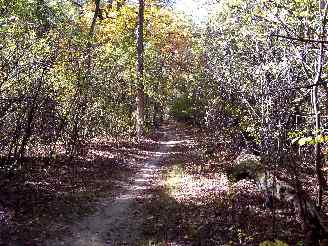
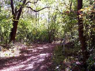
Back into the woods on a fairly flat soft dirt section of the unpaved trail system in Deer Grove West. Keep in mind that these photos were taken before the unpaved trail upgrades (2004 and 2005) when the trails were little more than dirt hiking paths. I actually took a few photos of the some of the trails after the upgrades and even while they were still working on them. See the "DG Mtn Upgrade" link in the upper right column for these photos.
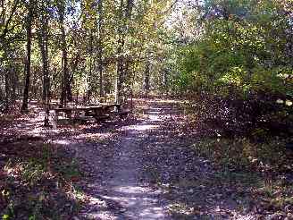
I'm not sure how or why, but there are a couple of picnic tables out here... Actually it
is a great place for a rest or a snack.... maybe even a picnic, if you are really up for
that... It is fairly private, but you do have bikers and hikers out here on nice days...
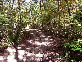
Another one of the "letter" markers... ("D"). This is looking back (at
the sign) after a pretty steep drop off.
This is a little hard to see in the picture and with the leaves, but it is a stone
bridge. What I think is interesting about this is... How did they build this way
back in the woods? This is a pretty remote location, currently only accessible by the dirt
hiking/biking path... Who paid for it? How did they get the stones out here???
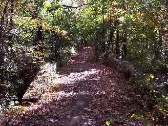
Back on the trail again... BTW: You can get lost back here...
Eventually you will make your way out again, but it can take quite a while if you really
get turned around... If you are going to explore a lot, you may want to review the forest
preserve trail system maps that I linked to at the start of this article... (The site is
fpdcc.com if you missed it). There are also a few good large maps in the Forest Preserve.
I know there is a good color one at the toboggan slide area.
The photo tour of Deer Grove West unpaved "mountain" bike trails (October 2004).
Deer Grove Mountain Trail Photos 1 - Yellow and Black Trail Intersection
Deer Grove Mountain Trail Photos 2 - Rugged Unpaved Sections
Deer Grove Mtn Trail Photos 3 - When it was a Dirt Trail < You are here
Deer Grove Mountain Trail Photos 4 - To Hillside Road in Barrington
Deer Grove Mountain Trail Photos 5 -Scenes from the Orange Trail
The photo tour of Deer Grove Bike Paths (paved, May 2003).
Deer Grove Bike Path Photos 1 - Northwest of Quentin and Dundee
Deer Grove Bike Path Photos 2 - West of Quentin
Deer Grove Bike Path Photos 3 - East of Quentin to 3 Mile Loop
Deer Grove Bike Path Photos 4 - Three Mile Loop east of Quentin